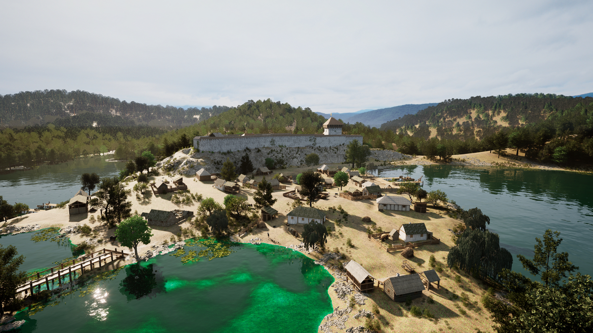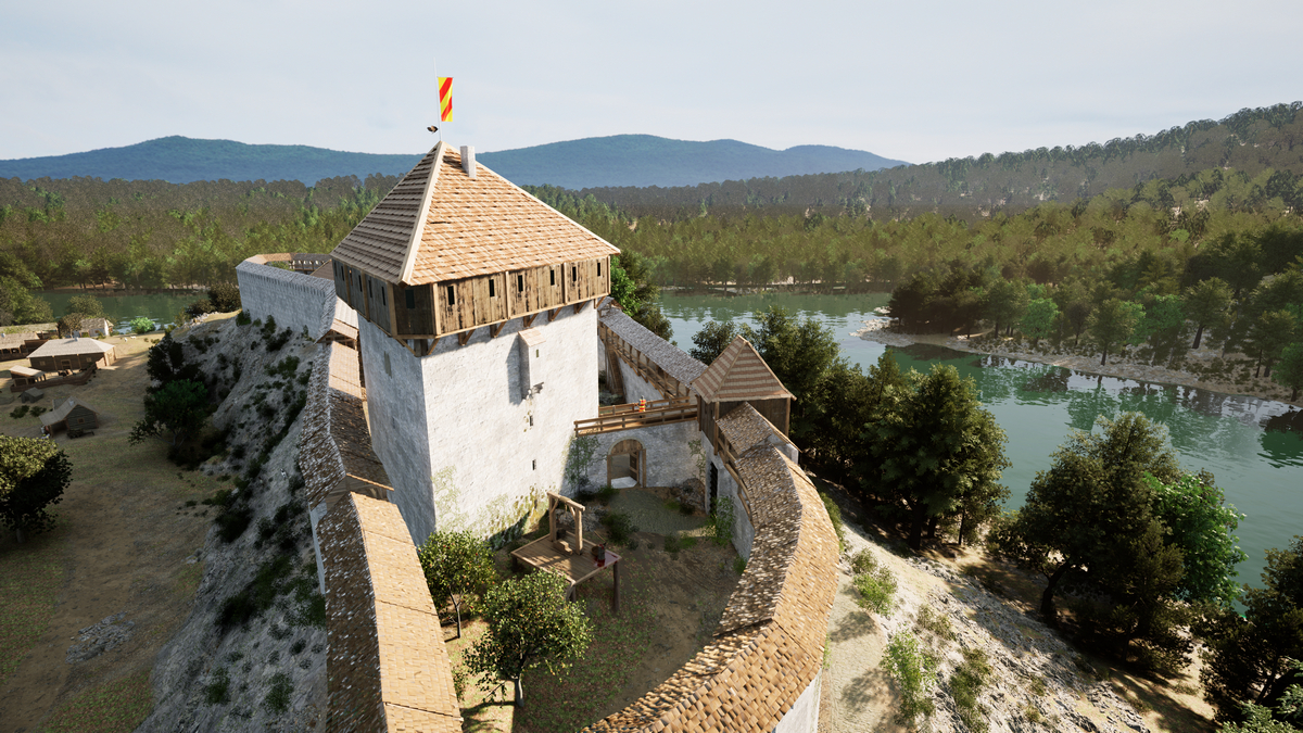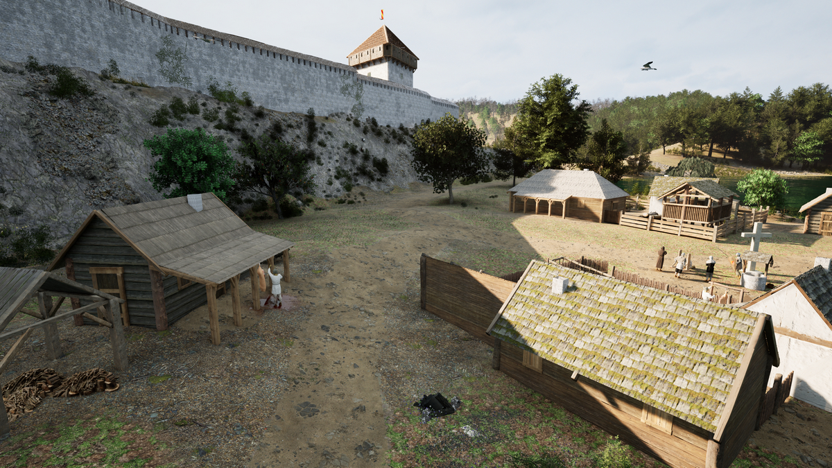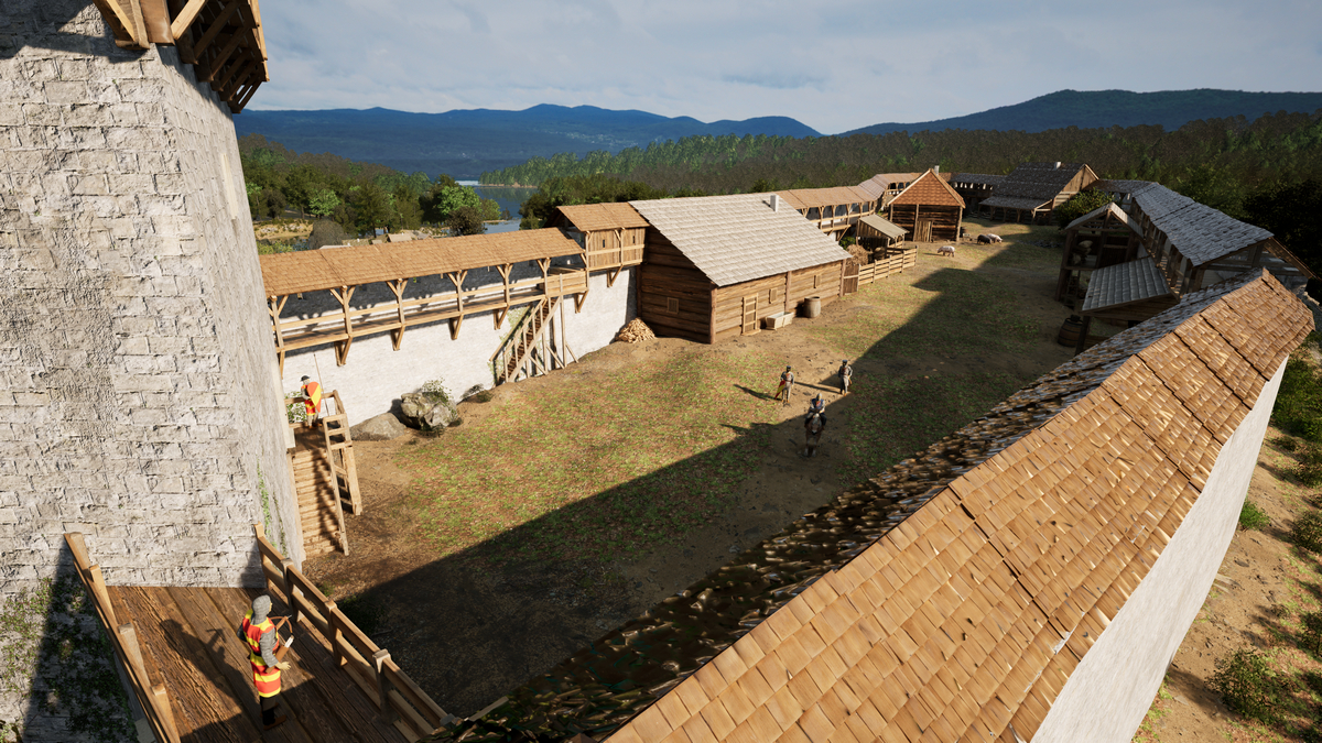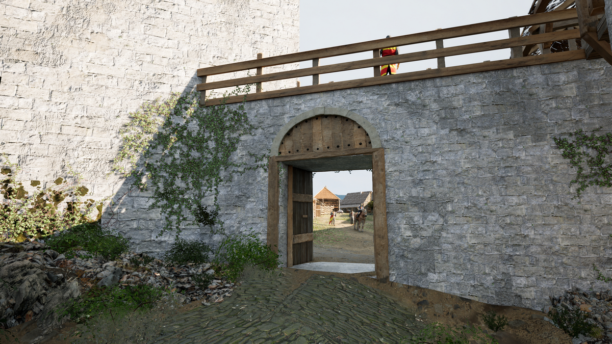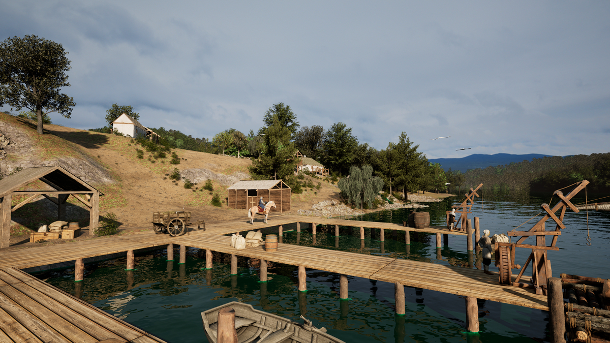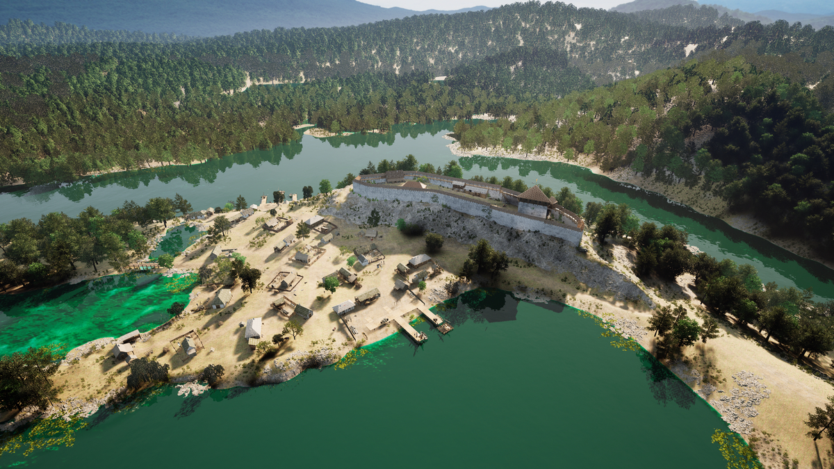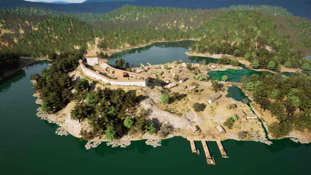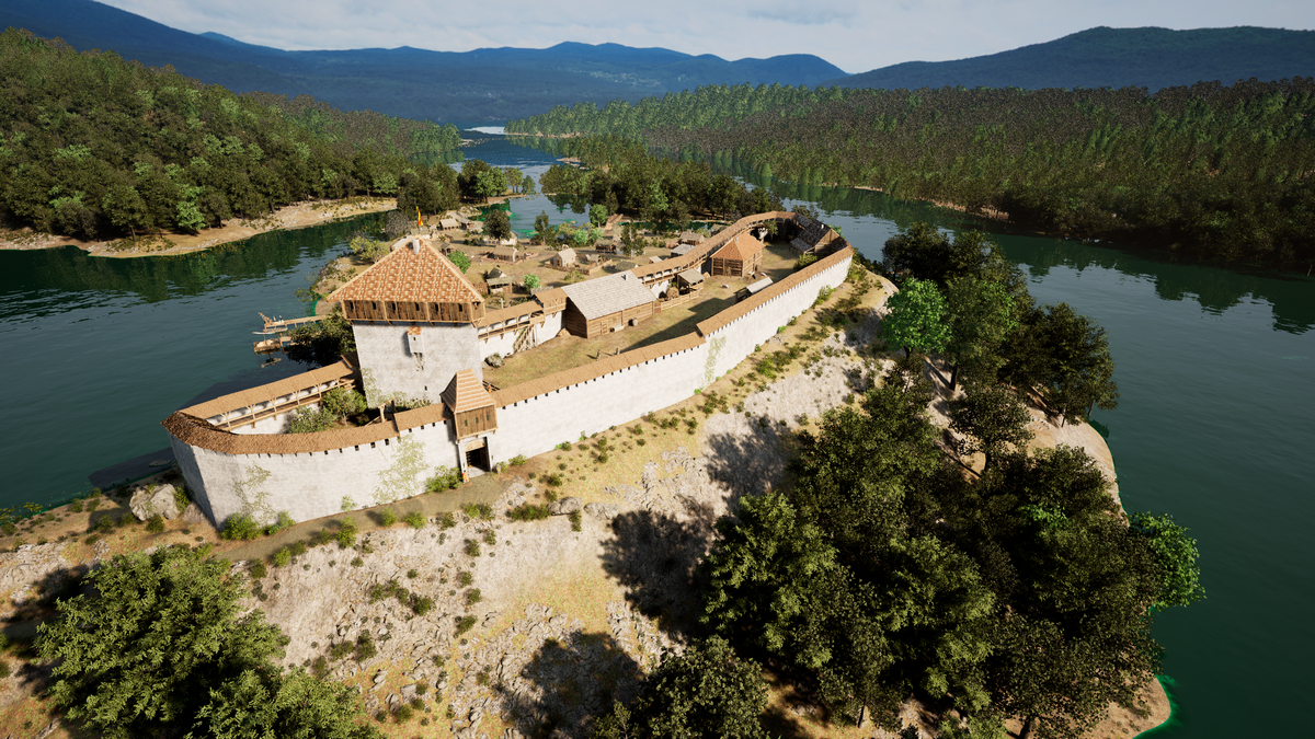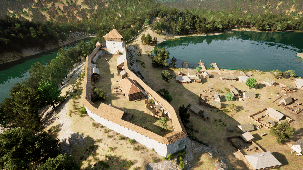
The Old Town of Krčingrad is located on a peninsula between Gradinsko and Kozjak Lakes, within Plitvice Lakes National Park. The naturally protected site was further fortified with a defensive wall made of travertine and a triangular tower that guarded the only land access to the town.
Despite its exceptional location and architectural design, very little is known about Krčingrad’s past due to the lack of preserved written records. However, archaeological research and the interdisciplinary contextualization of historical data suggest that it was built at the turn of the 13th and 14th centuries by the powerful dukes of the Babonić family. In addition to overseeing a medieval trade route that passed through the Plitvice Lakes area, the Old Town of Krčingrad served as a stronghold for one of the most influential noble families in late medieval Slavonia. The estates of the Babonić dukes spanned the region between the Krka, Sava, Una, and Korana rivers, and family members held some of the highest positions in the Kingdom. It’s believed that Krčingrad was abandoned in the early 14th century due to political changes in the Kingdom and was left to gradually fall into ruin. In the 18th and 19th centuries, the remains of the town were dismantled for use in building numerous military and civilian structures for the Slunj Border Regiment.
The main tower after archaeological excavations in 2019
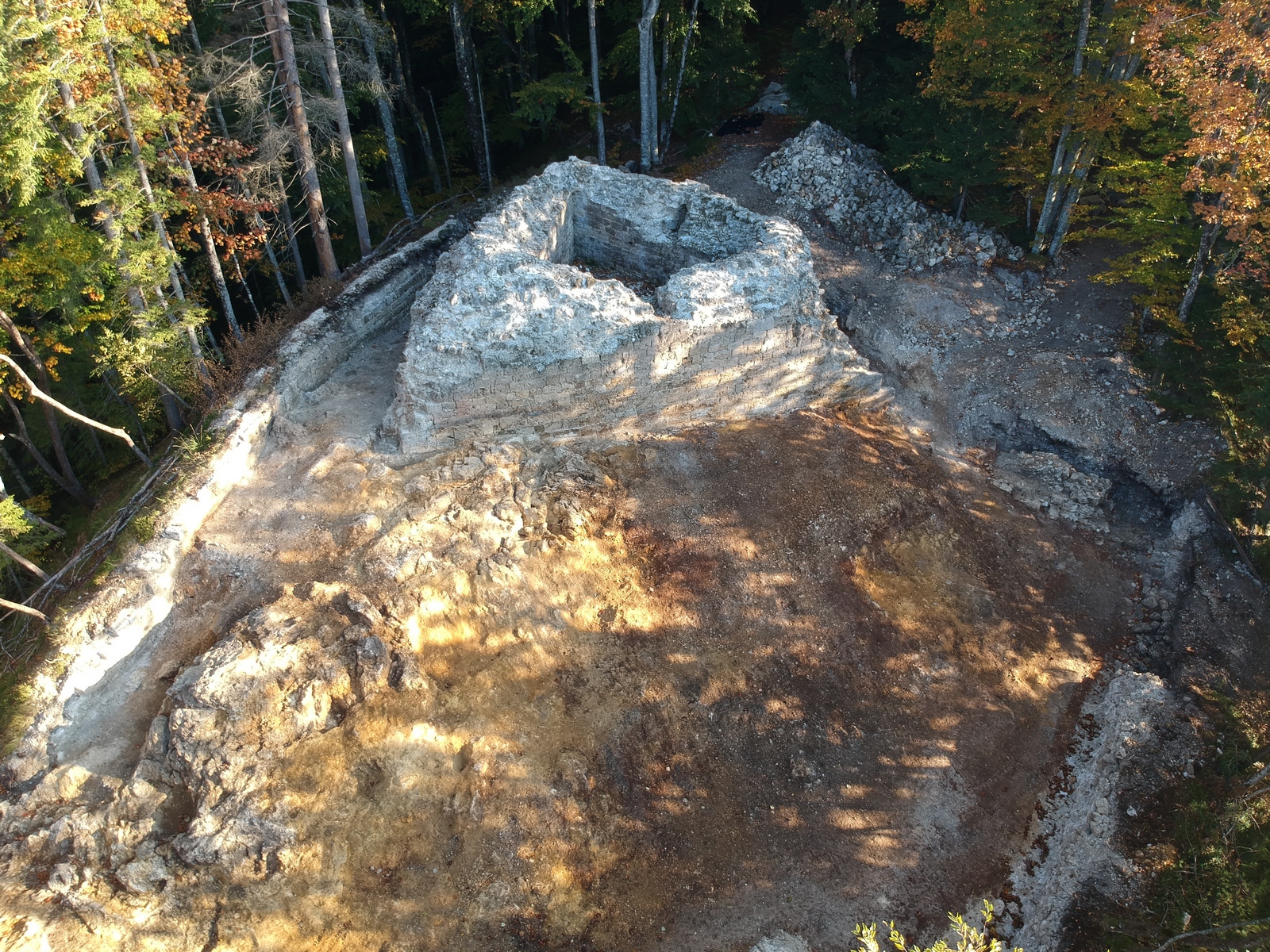
Although archaeological excavations of Krčingrad began in 1911 under E. Laszowski, work continued almost a century later. During four seasons of archaeological research – 2008, 2009, 2013, and 2014 – the Croatian Conservation Institute conducted research on the triangular tower and its immediate surroundings. In 2019, they explored the southern part of the town, including the main tower and defensive wall, and in 2020, further excavation of the southern defensive wall took place.
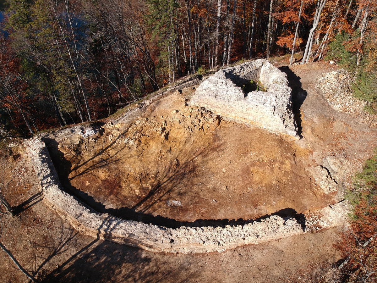
The main tower and the southern part of the defensive wall after archaeological excavations in 2020
In 2022, archaeologists explored the northern plateau of Krčingrad, as historical sources suggested the presence of a monastery, church, or other parts of the town. Unfortunately, during field excavations of the entire area no remains of buildings were discovered, only the remains of a defensive wall around the edge of the plateau, which was already known to exist because it was partially visible.
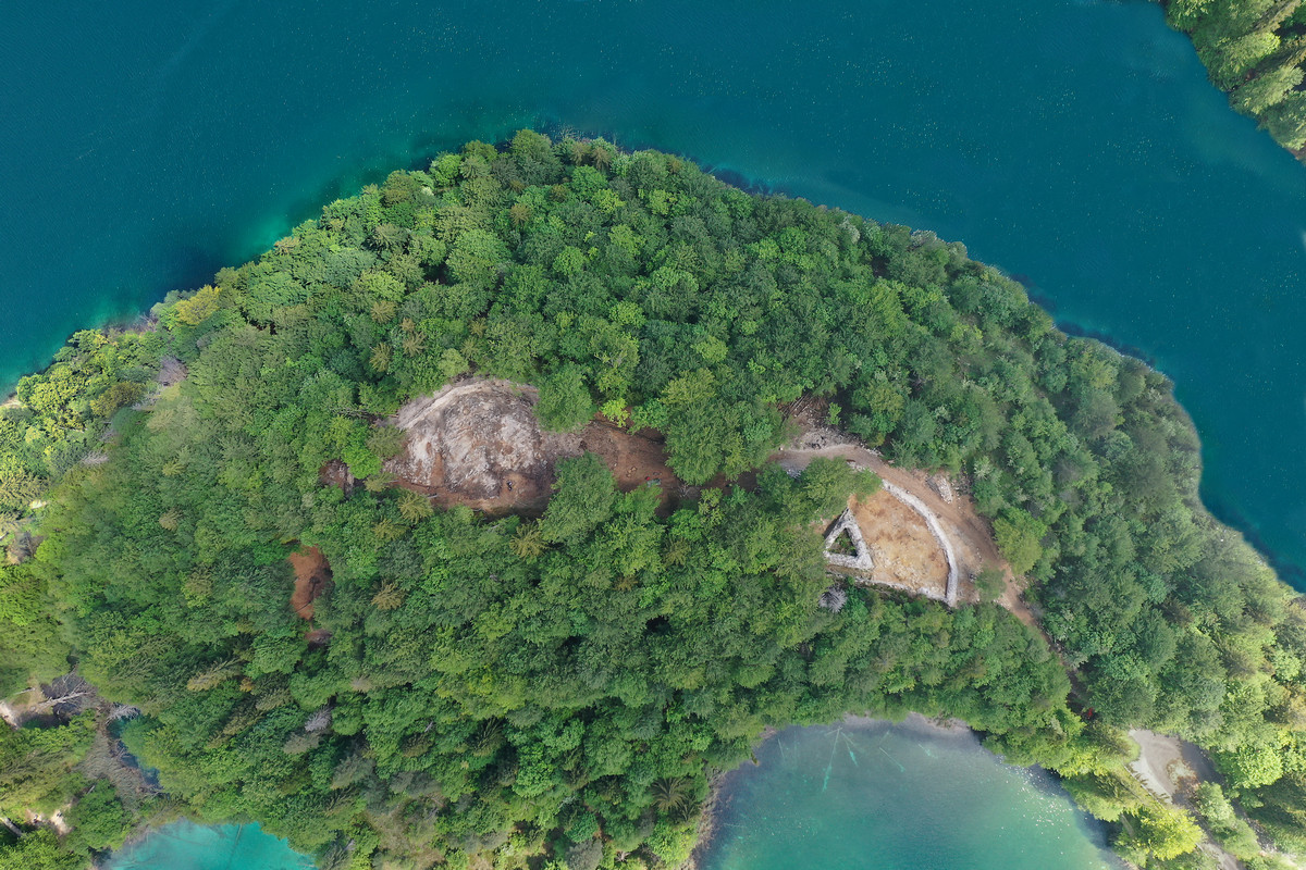
The main tower and the entire plateau of Krčingrad after archaeological excavations in 2022
The findings from these excavations highlight Krčingrad’s historical, archaeological, artistic, cultural, and landscape value, as well as its clear potential as a tourist destination. According to the criteria of cultural management, Krčingrad is considered part of the architectural heritage that meets all the conditions for positive development. The site is in an ideal location with views of the waterfalls and lakes (Gradinsko and Kozjak), and is easily accessible via existing routes (by tourist train from the south, Štefanija’s path from the southwest and northwest, or by boat from the north). The excavated area is visually striking and, with the right presentation, could become an interesting cultural attraction, complementing the existing, well-developed tourism infrastructure.
Conservation work on Krčingrad’s main tower is planned for completion in 2025, with further plans to preserve the excavated sections of the defensive wall in the coming years.
To better present the story of Krčingrad, a 3D visualization of the assumed appearance of the town has been created, as shown in the following images.